Quick
Links
Photos
View on Google Map
(to pan, zoom, etc...)

On June 18, 2007 I completed a solo counterclockwise bike ride around the Hawaiian island of Oahu that stands out as one of my most scenic and memorable cycling adventures. It also made Hawaii the 14th state where I have ridden 100 miles or more in a single day. Starting from the Hale Koa hotel in Waikiki Beach, this route took me around Diamond Head crater, along the eastern/windward coast, past Sunset Beach and Waimea Falls on the north shore, around Schofield Barracks (in the center of the island), through Honolulu, and back to the Hale Koa.
Route Options
While planning this adventure, I originally entended to extend the route along
the western portion of the north shore, then travel along the west coast before
returning to Honolulu. However, I quickly discovered a significant problem with
that plan. The Farrington Hwy ends on the north shore before reaching Keana
Point and doesn't resume until well down the west coast. That meant a rather
unpleasant 2-hour walk carrying a bike over loose sand for the missing 5.0 miles.
Alternatively, I could have walked 1.8 miles then carried the bike up the mountain
to the Keana Point Air Force Satellite Tracking Station (940 ft elevation, 33%
average grade for 0.53 miles). On some other day I might have explored both
options, but riding solo I felt both were too much and the second option also
too dangerous.
|
Quick
Links
View on Google Map |
 |
|
Route ridden Monday, Jun 18, 2007 |
The scenery along the south shore from Waikiki Beach to the east, along the entire east coast and north shore to Haleiwa is simply spectacular. White sandy ribbons are squeezed between the sea and ancient deeply eroded volcanoes vailed in lush tropical plants. These photos are a small sampling of the visual treasures found there. By contrast the grassy central area is not so attractive, but what it lacks in beauty it makes up for in climbing challenge.
Overall the climbing on the route was not too difficult as most of 4850 ft of climbing was concentrated into a few large rollers between Diamond Head and the town of Kailua, and a 3.4-mile climb with an average grade of 4.6% between the north coast and Schofield Barracks.
 |
|
Elevation
profile generated from a GPS log file |
The Schofield Barracks climb, by far the biggest on the route, was a bit ironic as it climbs over a valley. Climb a valley? Yes, Kaukonahua Rd (SR 803/801) cuts between Kamaohanui mountain (4000 ft) to the west and the Puu Kaaumakua ridge (2800 ft) to the east. This broad saddle-shaped valley has a high spot of 1012 ft. near Schofield Barracks.
Unfortunately, this broad grassy agricultural area is not very scenic and was also hot at mid-afternoon on that June day. If you do this ride I high recommend stopping in Haleiwa to get yourself well-hydrated and fill your water bottles before tackling the 'saddle'. Also SR 803 and 801 are somewhat narrow and cars don't give cyclists much room as they pass. I countered this by positioning myself 2 to 3 feet into the traffic lane. This forced the drivers to wait for on-coming traffic to clear before attempting to pass me; instead of trying to squeeze between me and the approaching vehicles. Traffic was light enough for this to work really well. Had traffic been heavier and a caused a vehicle to be delayed more than a few seconds behind me, I would have pulled over to allow it to pass.
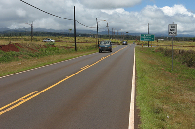
Overall I found the roads comfortably wide with smooth surfaces, except for a stretch in the northeastern corner (just north of the Polynesian Cultural Center) where the surface was a little rough for a few miles.
 |
|
Uninspiring 1012 ft summit near Schofield Barracks, mile 85 |
After the cresting the rather anti-climatic high point of the 'saddle', the brisk descent through the town of Wahiawa was rudely interrupted by two nasty little climbs. I say 'nasty' because they rose out of arid sun baked dales absent of any breath of wind. These were the most uncomfortably hot conditions of the day, but mercifully brief. After topping the last one I was treated to refreshingly cooler air for my decent into the broad Honolulu coastal plain.
From there back to my starting point in Waikiki Beach, I found there was really no avoiding industrialized west Honolulu and its urban center so I opted for a route along the south shore. This at least provided an occasional nice view of Pearl Harbor and the Ocean. My GPS really helped in this section as I navigated smoothly and confidently through this inner-city maze. As I entered the familiar grounds of the Hale Koa Hotel, I felt a little strange to be there having traveled so far over such a variety of unfamiliar terrain. I had to pause for a moment to comprehend it. I had traveled full-circle using the largest practicle loop around this remote Pacific Island. Suddenly the ride was over and there I was.
 |
 |
|
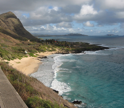
View of Diamond Head Crater looking west over Maunalua Bay, mile 11 |
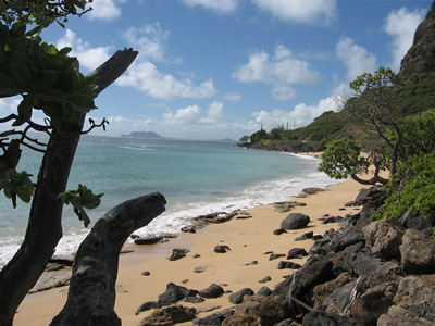
Makapuu Beach Park, mile 17 |
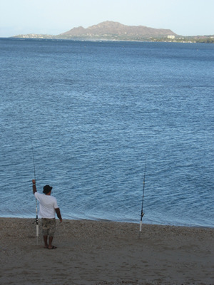
Photos along the east shore
 |
 |
|
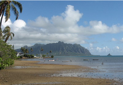
Kaneohe
Bay, |
Beach in the Kaawa Valley, mile 43 |
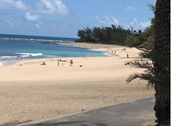
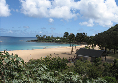
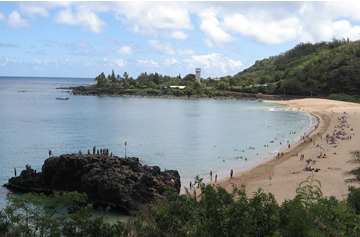
Photos along the north shore
 |
|
Surfing
meca Sunset Beach, |
 |
 |
|
Waimea Bay Beach Park, mile 67 |
Bathers
climb and jump off of the lava formation at |
Haleiwa is a quiant little town that is a great place to fuel up before heading back to Honolulu over the 1012 ft. 'saddle'.
 |
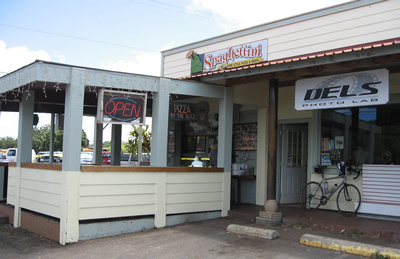 |
| New York style pizza at Spaghettini's. Two slices and a drink for $6.35 ... delicious! | Spaghettini restaurant in Haleiwa, mile 72 |
If you would like to do this ride you will need a decent road bike. Although I have packed and shipped my own bike on other purely cycling vacations, I wanted to avoid the hassles of lugging my bike with me on this family-oriented trip with my wife and young daughter; so I rented one from 'The Bike Shop' in Honolulu for a reasonable $40 per day. The aluminum bike I received was in good working order and the mechanic installed my aerobars at no extra charge. They even supplied a small saddle bag with a spare tube, but I used my own instead. I also brought my helmet, water bottles, gloves, and of course GPS. With all of my own familiar accessories I really felt right at home on this rig. Click on the 'Hono,BikeShop' button on the map belown to zoom-in and center the map on the location of where I rented this bike (it is indicated by an icon that looks like a shopping cart).
If the map isn't already shown below, click on the 'Show Map' button to view the GPS file of this ride. Download the GPX file (314KB) displayed in this map by right-clicking on the link above and select 'Save As'. Since, it's a vendor independent GPX format you should be able to upload it to any mapping GPS unit directly or using the software that came with your unit. However, some waypoint symbol types described may be specific to Garmin.
|
|
|